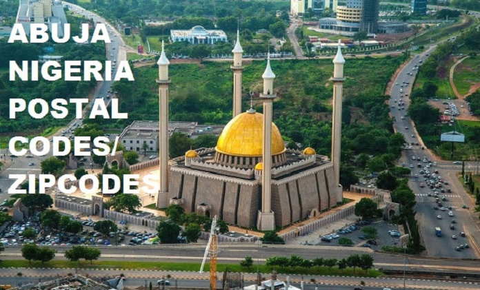
The city of Abuja might be one of the smallest major territories in Nigeria. Still, it accommodates many people as it is the 8th most populated city in the country. As at the last census in 2011, the Federal Capital Territory was estimated to accommodate over 1.2 million Nigerians. The people residing in the capital city of Nigeria share a range of postal codes within 900001 to 950102. Among those who share in these postal codes is the country’s number one citizen President Muhammadu Buhari.
What is a Postal Code?
A postal code or postcode is a series of digits or alphabets and digits assigned to geographical areas designed to receive many mails. Simply put, they are strings of numbers or alphabets that help postal services determine where a piece of mail is being sent to. Of the 190 countries associated with the Universal Postal Union, 117 countries use postal code systems. Postal codes differ in different countries based on how they are assigned and the format they are arranged.
Postal Codes Can Be Used for Many Thing
Postal codes are very beneficial to individuals, the postal services, and the country at large. Here are some of the essential reasons why postal codes are important.
- These codes have gone beyond just being numbers that identify a location. They have become social identifiers – providing details on the demographics of the people in a particular geographical area.
- Companies use postal Codes as important data structures that give them a visual representation of their audience.
- In terms of delivering goods, giving your correct postal code helps deliver goods to the right address and at the appropriate time. Simply put, postal codes help simplify the postman’s job of bringing a post to its destination.
- In some cases where we have similar street or town names but in different cities or districts, postal code helps differentiate these streets or towns with similar names.
- Brands collect postal codes of their customers to identify which location they have more or less audience, which would aid in making marketing decisions such as opening or closing stores in that location or launching new products.
- Providing correct postal codes helps to validate and verify addresses.
How the Abuja Postal Codes are Classified
In Nigeria, the organization in charge of assigning postal codes is the Nigerian Postal Service, abbreviated as NIPOST. Nigeria postal codes are in digit forms only, and each contains six digits. NIPOST categorizes the country into nine regions, and the first digit represents the region under which the area falls. For example, all zones within Abuja have 9 as the 1st digit of their postal codes because Abuja falls within the 9th region.
The first digit, combined with the second and third digits, represents the dispatch district for outgoing sorting, while the fourth, fifth, and sixth digits represent your local post office.
List of Council Division in Nigeria
The Federal Capital Territory consists of six area council divisions, including:
- Abaji
- Bwari
- Gwagwalada
- Kuje
- Kwali
- Abuja Municipal Area Council
It is important to note that locations within the different council divisions do not share similar postal codes. Instead, they have their separate postal codes.
Here’s A Complete List of Postal Codes For all Abuja Districts
1. Abaji
The people of Abaji are the Hausa, Egbira, and Ganagana. Abaji is populated by 98,000 people and has a landmass of 922km2. Abaji Local Council consists of two districts which are: Abaji district and Yaba district.
a. Abaji district: All locations in this district use the common postal code of 950101.
Areas in Abaji district that share the 950101 postal code:
- Agyana
- Bogo
- Bandagi
- Dapala
- Ebagi
- Gbogbogo
- Kebba
- Manderegi
- Nah. Tosho
- Nahalati Sabo
- Nuku
- Panagana
- Rimba
- Uboshenu
- Yawule
b. Yaba district: All locations in this district use the postal code 950102.
Areas in Yaba district that share the 950102 code are:
- Abuja
- Adagba
- Afo
- Akori
- Alampa
- Allu
- Ayaba
- Bari-Bezi
- Busga
- Chakun
- Chundugo
- Dabbare
- Dara
- Dewu
- Domi
- Dum
- Ekki
- Fakon tando
- Gadabiri
- Gari
- Gasakba
- Gasukpa
- Gawu
- Gawun
- Gidan Maisaye
- Gurdi
- Guruza
- Gwanda
- Gwona
- Jamigbe
- Kafako
- Kpace
- Kilarida
- Kutara
- Kwago
- Kwakwa
- Kyawu
- Lafia Yaba
- Managi
- Nadichi
- Nagun
- Nassarawa
- Nowog
- Nyembo
- Pako Base
- Panagu
- Pandaji
- Pankuru
- Panpari
- Piowe
- Sabongida
- Sorowo-abdu
- Selifulyu
- Shadad
- Soitan
- Takpeshi
- Talpa
- Tanaga
- Wapa
- Yelwa
- Yelwa Gawu
- Zuwa
2. Bwari
The people of Gbagyi are the original inhabitant of Bwari. As assigned by NIPOST, locations in Bwari share the 901101 postal code.
Here are the areas in Bwari that operate on the 901101 postal code.
- Apugye
- Barago
- Baran Rafi
- Barangoni
- Barapa
- Bazango Bwari
- Bunko
- Byazhi
- Chikale
- Dankoru
- Dauda
- Donabayi
- Duba
- Dutse Alhaji
- Gaba
- Galuwyi
- Gidan Babachi
- Gidan Baushe
- Gidan Pawa
- Gudupe
- Gutpo
- Igu
- Jigo
- Kaima
- Karaku
- Karawa
- Kasaru
- Katampe
- Kawadashi
- Kawu
- Kikumi
- Kimtaru
- Kogo
- Kubwa
- Kuchibuyi
- Kuduru
- Kurumin Daudu
- Kute
- Kwabwure
- Panda
- Panunuki
- Paspa
- Payi
- Piko
- Rugan S/Fulani
- Ruriji
- Sabon Gari
- Sagwari
- Shere
- Simape
- Sumpe
- T/Danzaria
- T/Manu
- Tokulo
- Tudun Wada
- Tunga Bijimi
- Tunga-Adoka
- Tungan Sarkin
- Ushafa
- Yaba
- Yajida
- Yaupe
- Yayidna
- Zango
- Zuma
3. Gwagwalada
This area council in Abuja has a landmass of 1,043km2 and accommodates over two hundred thousand people. Locations in Gwagwalada share the same 6-digit postal code of 902101.
Locations under Gwagwalada:
- Agota
- Akwayi
- Akyakyata
- Alu Wamo
- Anguwar Hausawa
- Anguwar Sarki
- Atopi
- Auguwar-Madaki
- Bargada Bassa
- Basan Zuba
- Bassa
- Biyu
- Boka
- Chaboda
- Chitumu
- Chzako
- Dabagayi
- Dada
- Dada Gongo
- Dadabiri
- Damin Kara
- Dawaki
- Didan Tujura
- Diko
- Dikwa Gwari
- Dikwa Kotwa
- Dobi
- Doni
- Doruwa
- Eabodo
- Garin Godoso
- Gbadolo
- Gerin Angulu
- Gidan Ango
- Gidan Bala
- Gidan Dandu
- Gidan Gade
- Gidan Golo
- Gidan Yaro
- Goi
- Goi Sabo
- Gongo
- Gulupe
- Gurebare
- Gurfa Gongo
- Gurfata
- Gurfata Sabo
- Gwako
- Gwale
- Gwari
- Gwaywalada
- Gyabiri
- Hanagada Abdu
- Hanagada Bassa
- Ibbo
- Ibwa
- Ibwa Sarki
- Ikwa
- Isom Bassa
- Isom Fulani
- Jalita Gongo
- Jigodo
- Jiwape
- Kaburufi
- Kace Bassa
- Kace Sabo
- Kace Sarki
- Kaida Bassa
- Kaida Gwari
- Kaida Sabo
- Kalangu
- Kasanki
- Kpatawuro
- Kutabwche
- Kutunku
- Kuturpe
- Kwalikuzi
- Lafiya
- Ledi
- Ledi Sabo
- Madaki Abuche
- Maikaraya
- Maje Bassa
- Maje Tsoho
- Makama
- Momo Sabo
- Pabeyi
- Pagada
- Pagena I
- Paiken Korce
- Paiko
- Pajana II
- Pako
- Paso Gwari
- Pass Kutawa
- Patte
- Rafin Zurfi
- Rain Zurfi
- S/Ganuwa
- Sabo
- Saboda
- Sabon Gari
- Shaga I
- Shaga II
- Shajantara
- Shanagu
- Shara Bassa
- Shibo
- Shibo Bassa
- Shida
- Shidahida
- Shinge
- Soko
- Tsagban Siji
- Tsaunia Kura
- Tsudna
- Tundun Wada
- Tung Tsauni
- Tunga Makeri
- Tungan Adamu
- Tungan Auta
- Tungan D. Kolo
- Tungan Giwa
- Tungan Jika
- Tungan Kakaki
- Tungan Ladan
- Tungan M. Hassan
- Tungan Maikasuwa
- Tungan Pada
- Tungan S. Pada
- Tungan Tsauni
- Tungan Salihu
- Ung Gade
- Ung. Bassa
- Ung. Bassa
- Ung. Gwari
- Wagu Wase-Gyan
- Wuma
- Wumi
- Wurumbi
- Wuye-Wuye
- Yaluan Ibwa
- Yemipe
- Zuba
4. Kuje
Kuje is about 40km southwest of Abuja. With a population of over a hundred thousand Nigerians, it has a landmass of 1,644km2. Kuje Area Council has two districts which are Kuje and Rubbochi districts.
Places in Kuje districts make use of 903101 postal codes, while Rubbochi districts make use of 903102 postal codes.
5. Kwali
This area council occupies 1,206km2 and recorded 85,837 occupants during the census carried out in 2006.
Districts in Kwali and their postal codes
- Pai: 904101
- Dafa: 904102
- Yangoji: 904103
- Kilankwa: 904104
- Kwali: 904105
- Yebu: 904106
- Gumbo: 904107
- Ashara: 904108
- Wako: 904109
6. Abuja Municipal Area Council
The Abuja Municipal Area Council is divided into 27 districts, with each district having a unique postal code shared by all locations within them.
Here are the 27 districts attached to the Abuja Municipal Area Council and their unique postal codes:
- Asokoro – 900231
- Abuja Central Business district – 900211
- Garki Area 1 – 900241
- Garki Area 2 – 900242
- Garki Area 3 – 900243
- Garki Area 7 – 900244
- Garki Area 8 – 900245
- Garki Area 10 – 900246
- Garki Area 11 – 900247
- Garki Rural Areas – 900104
- Gwarimpa – 900108
- Karu – 900110
- Maitama – 900271
- Nyanya – 900103
- Three Arms – 900221
- Wuse II – 900288
- Wuse Zone 1 – 900281
- Wuse Zone 2 – 900282
- Wuse Zone 3 – 900283
- Wuse Zone 4 – 900284
- Wuse Zone 5 – 900285
- Wuse Zone 6 – 900286
- Wuse Zone 7 – 900287
- Gui – 900105
- Gwagwa – 900106
- Kabusa – 900107
- Orozo – 900109


