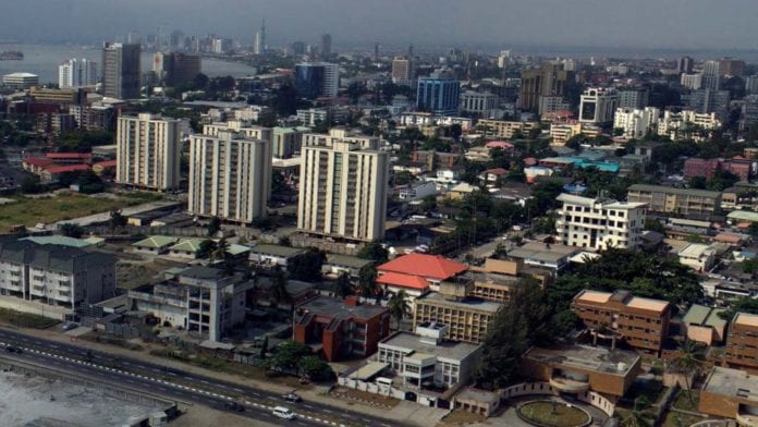
Nigeria is one of Africa’s most populous countries with an economically diverse population spread across its 6 geopolitical zones. In each geopolitical zone, there are at least 5 states and a total of 36 states, and a federal capital territory. In each state, different levels of economic activities take place on a daily basis resulting in the gross domestic product (GDP) of varying monetary proportions. It has been seen that while some states are rich and almost self-reliant, others can’t survive without the monthly allocation they get from the federal government of Nigeria.
These Are The Richest States In Nigeria In Ascending Order:
1. Kaduna State
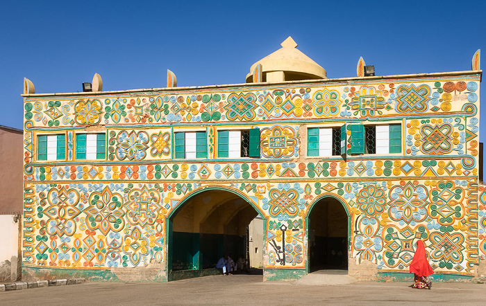
- Name: Kaduna State
- Capital: Kaduna
- GDP: $10.33 Billion
- Geographical Zone: North West
- Landmass: b46, 058 KM2 (17, 781 sq m)
- Population: 6, 113, 503 Est
- Famous Landmark: Arewa House
- Coordinates: 10* 20 N 7*45 E
- Rich in: Peanuts and Cotton
- Ethnic Group: Hausa
Present-day Kaduna is home to the famous NOK civilization in Northern Nigeria. The name Kaduna was adopted by Lord Fredrick Lugard when Kaduna was made the colonial headquarters of Nigeria. Kaduna State was created on 27th May 1967 by General Murtala Muhammed. Hausa is the most spoken language and the major population is Muslim.
Agriculture contributes about 30% of the state’s economy; they cultivate cotton for their textile company, spices, groundnut (in pyramids) for export. They also engage in tie and dye, weaving, leatherwork. These works are transported to the Southern part of the country where it is scarce and it sums up their economic activities.
2. Ogun State
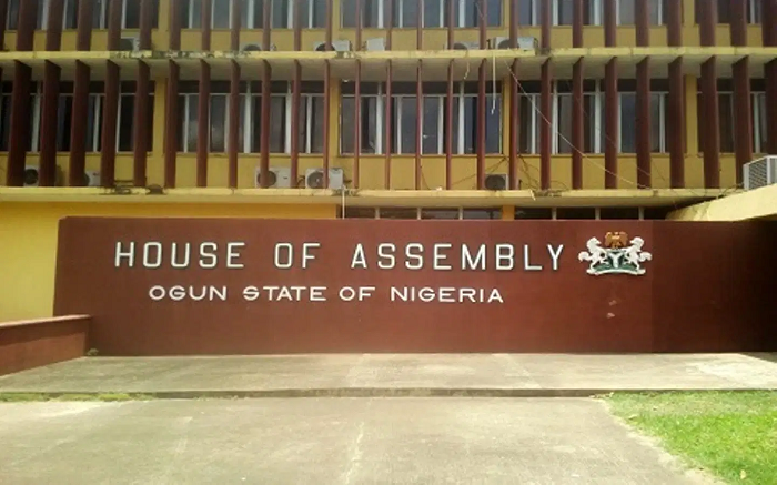
- Name: Ogun State
- Capital: Abeokuta
- GDP: $10.47 Billion
- Geographical Zone: South West
- Landmass: 16, 980 KM2 (6, 556 sq mi)
- Population: 3,751,140 Est
- Famous Landmark: Oluma Rock
- Coordinates: 7* 00 N, 3*35 E
- Rich in: Limestone and Granite
- Ethnic Group: Yoruba
Ogun State was created on 3rd February 1976 by General Murtala Muhammed’s military regime. The State is predominantly Yoruba and is regarded as the Industrial Hub of the nation. Industries in the region include Procter and Gamble, Nestle, Lafarge, Dangote cement factories, Coleman Cables, Ota Farms amongst other establishments.
These factories provide employment for the citizens of the state as well as Nigerians from other states who come to Ogun in search of greener pastures. The state is nicknamed the Gateway State.
3. Akwa Ibom State
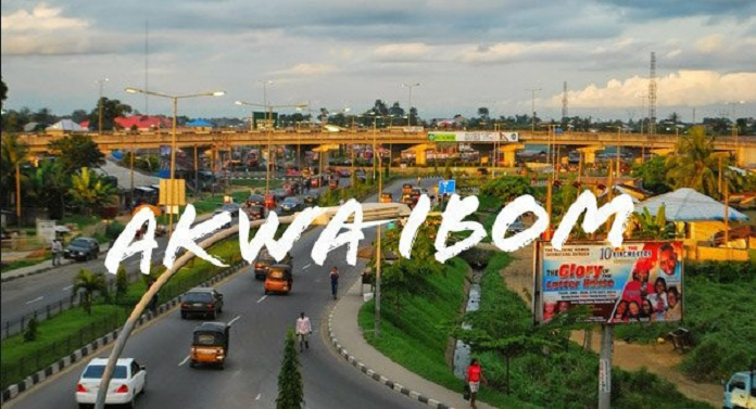
- Name: Akwa Ibom State
- Capital: Uyo
- GDP: $11.18 Billion
- Geographical Zone: South-South
- Landmass: 7,081 KM2 (2, 734 sq mi)
- Population: 5,450,758 Est
- Famous Landmark: Ibom E-Library
- Coordinates: 5* 00 N, 7*50 E
- Rich in: Crude Oil and limestone
- Ethnic Group: Ibibio, Urhobo, and Annang
Akwa Ibom state was created on 23rd September 1987 by General Ibrahim Babangida’s regime from the former Cross River State and it is the highest crude oil and natural gas-producing state in Nigeria. The state is predominantly a Christian state with Ibibio, Annang, Obolo, Oro, and Eket as the major languages spoken in the state.
Their status as the highest oil-producing state has increased economic activities in the state as there are many foreign and indigenous oil and gas companies in the state. Its proximity to the Atlantic Ocean gives it the opportunity to operate a major seaport at Ibaka Oron. Fishing is a predominant economic activity for the locals as they trade their fish products for basic foodstuffs they are unable to produce. Aside from fishing, the people are into refining local brews and selling cash products like Palm Oil.
4. Edo State
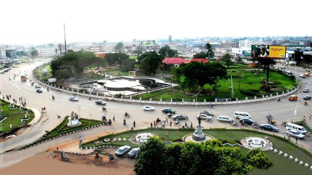
- Name: Edo State
- Capital: Benin City
- GDP: $11.89 Billion
- Geographical Zone: South-South
- Landmass: 17, 802 KM2 (6, 873 sq mi)
- Population: 3, 233, 366 Est
- Famous Landmark: Emotan Statue, Ise Lake
- Coordinates: 6* 30 N, 6*00 E
- Rich in: Crude Oil and limestone
- Ethnic Group: Bini and Esan
Benin City is the modern-day ancient Benin Empire that flourished in the Mid Western region of Nigeria. Edo State was created on 27th August 1991 from Benin and Delta provinces of Mid Western region (1963 – 1991). It is a Christian-dominated region with the Bini and Esan being the major ethnic groups.
With the discovery of Crude oil deposits, exploration commenced thereby increasing economic activities in the state. Aside from oil, tourist sites like the Emotan Statue, River Niger Beaches also provide revenue for the state. Quarry and limestone are also available which is the reason for the establishment of the Asoka Cement plant which also provides employment opportunities. Agriculture and fishing are predominant occupations.
5. Kano State
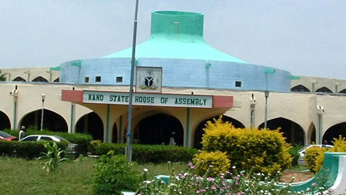
- Name: Kano State
- Capital: Kano
- GDP: $12.39 Billion
- Geographical Zone: North West
- Landmass: 20, 131 KM2 (7, 773 sq mi)
- Population: 11, 058, 300 Est
- Famous Landmark: Gidan Rumfa Emirs Palace
- Coordinates: 11* 30 N, 8*30 E
- Rich in: Cotton and Soya beans
- Ethnic Group: Hausa
Kano state was the site for a flourishing empire that gave rise to the Trans-Saharan trade. Kano State was created on 27th May 1967 from the former Northern region under the General the Yakubu Gowon military regime. It is predominantly a Hausa-speaking region that is predominantly Muslim.
Economic activities in the region include large markets where traders from far and near converge to transact large volumes of business. They also farm commercial quantities of products like soya beans, cotton, groundnut, hide and skin, spices, and sesame. Agriculture and commerce are their basic economic activity.
6. Imo State
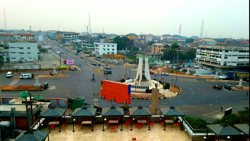
- Name: Imo State
- Capital: Owerri
- GDP: $14.21 Billion
- Geographical Zone: South East
- Landmass: 5, 530 KM2 (2, 140 sq mi)
- Population: 4, 927, 563 Est
- Famous Landmark: Oguta Lake
- Coordinates: 5* 29 N, 7*2 E
- Rich in: Crude Oil and Natural Gas
- Ethnic Group: Igbo
Imo state was created on 3rd February 1976 under the General Murtala Muhammad regime. It split from East-Central State; it is predominantly an Igbo-speaking state and the center of resistance during the Nigerian civil war on the Biafran front. The state is endowed with natural resources like lead, calcium carbonate, zinc, etc.
The people of Imo State depend mainly on agriculture and trading. Oil and gas exploration only started recently and it has since then added to the economic activities of the state by creating employment and generating income for the people and state government.
7. Oyo State
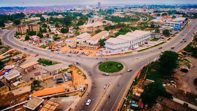
- Name: Oyo State
- Capital: Ibadan
- GDP: $16.12 Billion
- Geographical Zone: South West
- Landmass: 28, 454 KM2
- Population: 5, 580, 984 Est
- Famous Landmark: University of Ibadan
- Coordinates: 8* 00N 4*00 E
- Rich in: Oil and Natural Gas
- Ethnic Group: Yoruba
Oyo State is the remnant of the defunct Oyo Empire and a historic city for the Yoruba speaking group in Nigeria, Oyo State was formed in 1976 from the Western part of Nigeria along with Ogun State. The state split in 1991 and is the third-most populous city in the country. A majority of its inhabitants are farmers. They plant cash crops like cocoa, tobacco, orange, and rubber. They also produce food crops in commercial quantities for economic purposes.
8. Delta State
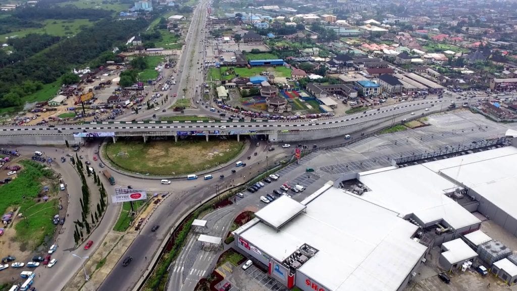
- Name: Delta State
- Capital: Asaba
- GDP: $16.75 Billion
- Geographical Zone: South-South
- Landmass: 17, 698 KM2 (6, 833 sq mi)
- Population: 5, 663, 400 Est
- Famous Landmark: Mungo Park House
- Coordinates: 5* 30N 6*00 S
- Rich in: Oil and Natural Gas
- Ethnic Group: Ijaw, Urhobo, and Isoko
Delta State is located in the Southern part of Nigeria, the State was created out of the defunct Bendel State on 27th August 1991 by General Ibrahim Badamasi Babangida. The state is endowed with oil and gas, limestone, tar sand, and decorative rocks. With its huge deposits of oil and gas, refining this product boosts the economy as well as agricultural products that are gotten from the fertile regions along the lower Niger. Fishing is also a major occupation for the people, it provides food and income for the locals.
9. Bayelsa State

- Name: Bayelsa State
- Capital: Yenogoa
- GDP: $21.17 Billion
- Geographical Zone: South-South
- Landmass: 11, 070 KM2 (4, 159 sq mi)
- Population: 1,704, 515 Est
- Famous Landmark: Bayelsa National Forest
- Coordinates: 4* 45N 6*05 S
- Rich in: Oil/Gas and Uranium
- Ethnic Group: Ijaw and Isoko
Bayelsa State was created on 1st October 1996 by the General Sanni Abacha regime. The state has one of the highest deposits of crude oil and natural gas, which accounts for about 60% of the country’s crude oil output. Another occupation of the people is fishing because of the available water resources. Revenue gotten from oil exploration is used for community development and providing employment opportunities for the citizens of the state.
10. Lagos State
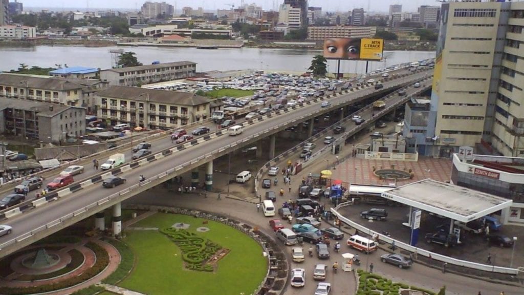
- Name: Lagos State
- Capital: Ikeja
- GDP: $33.679 Billion (2014)
- Geographical Zone: South West
- Landmass: 3,577 KM2 (1, 381 sq mi)
- Population: 49, 552, 940 Est
- Famous Landmark: Third Mainland Bridge
- Coordinates: 6* 35N 3*45 S
- Rich in: Bitumen and Clay
- Ethnic Group: Yoruba
Lagos state is the richest state in Nigeria, it was founded on 27th May 1967 and was the then Federal Capital Territory for the colonial administrators. Lagos also served as a major financial center as it is Nigeria’s largest urban area. Its outlet to the Ocean makes it possible to have a seaport which has increased the economic activity of the region, it serves as a source of revenue and employment for the state.
Victoria Island is the financial center of the State. Its Southern borders open to the Atlantic Ocean, about 22% of its landmass is covered with creeks and lagoons. Its slogan is Centre of Excellence. The seaport provides employment for the residents and makes goods readily available for trading purposes. Most organizational headquarters are situated in Lagos which also provides access to employment and opportunities.
Quick Recap of the Richest Nigerian States and their GDPs
- Kaduna – GDP: $10.33 Billion
- Ogun – GDP: $10.47 Billion
- Akwa Ibom – GDP: $11.18 Billion
- Edo – GDP: $11.89 Billion
- Kano – GDP: $12.39 Billion
- Imo – GDP: $14.21 Billion
- Oyo – GDP: $16.12 Billion
- Delta – GDP: $16.75 Billion
- Bayelsa – GDP: $21.17 Billion
- Lagos – GDP: $33.679 Billion
5 Poorest States In Nigeria
While we have outlined the top 10 richest states in Nigeria, we shall also look at the poorest states in Nigeria. These states have fallen under the poorest in Nigeria due to their low GDP, and they include;
- Jigawa State: located in the North-Western region of Nigeria, its capital is Dutse. It is predominantly inhabited by the Hausa/Fulani-speaking group. Due to mass illiteracy and harsh climate conditions, the state is the fifth poorest state in Nigeria with a poverty rate of 72.1%
- Gombe State: also located in the North-Western region of the country. Its capital is Gombe. Due to insurgency that has destabilized the region and lack of education, the state is unable to create wealth making it the fourth poorest state in Nigeria with a poverty rate of 73.2%.
- Adamawa State: its capital is Yola and it is located in North-Eastern Nigeria. The state is also one of the states affected by the Boko Haram insurgency, and its residence running for their dear lives thereby disrupting economic activities. This has made Adamawa the third poorest state in Nigeria with a 74.2% poverty rate.
- Katsina State: is the second poorest state in Nigeria located in the North-Western region. It has no mineral resources and no industries to boost the economy.
- Sokoto State: is the poorest state in Nigeria. It is located in the North-Western region of the nation in the fringe of the Sahara desert giving it a harsh climate condition. Its poverty level is 81%.
