
Every State in Nigeria is carved up into Local Governments that make up the 776 Local Governments. Among them is Lagos State, consisting of 5 divisions divided into 20 Local Governments and 37 Local Council Development Areas (LCDA). Lagos State is located in the South-Western region of Nigeria, between the Ogun State to the north and east, Bay of Benin to the south, and the Republic of Benin to the West. It was founded in the 15th Century and made a State in 1967.
At present, the State has risen to become one of the fastest-growing economic centers globally and the main business center in Nigeria, making about 10% of the country’s Gross Domestic Product (GDP). In terms of size, Lagos State is the smallest in Nigeria, with an area size of 3,345 square kilometers to make it 1000 square kilometers behind the second smallest state, Anambra. It is also more than 73,000 square kilometers smaller than Niger, the largest State in Nigeria. However, in terms of population, the State is leading with about 24 million population to make it the most populated State in Nigeria alongside Kano State.
What To Know About The 20 Local Governments of Lagos State
Badagry Division
The division contains 4 Local Government Areas and is best known for being a great historical marking in Nigeria. It was the first place Christianity was preached in Nigeria in 1842. The following are the Local Governments of the Division.
Ajeromi-Ifelodun Local Government
- Population: 687,316 (2006 Census)
- Size: 12.49 km2 (Area)
- Headquarters: Amukoko, Lagos State
- Best Known For: one of the densest places globally, with more than 57,000 people per square kilometer.
- Also Known As: Jolly City
- Most Popular place: Ajegunle, Awodi, Aiyetoro Ajeromi, Ashafa, Awodi, Cardoso, Orodu
The Local Government was previously a District Council, and in 1976, it became Awori-Ajeromi District Council. In 1980, during the creation of 23 Local Government Areas, it was turned to the Area office under Ojo Local Government. In 1996, it was again made a Local Government under the Badagry Division.
Amuwo-Odofin Local Government
- Population: 328,975 (2006 Census)
- Size: 114.2 km2 (Area)
- Headquarters: 31 Road, off 4th Avenue, Festac Town, Lagos State
- Best Known for: being an important commercial center in the State
- Also Known As: unknown
- Major Communities: Festac Town, Ibeshe, Abule-Osun, Ibese, Old Ojo Road, Abule Ado, Trade Fair Complex.
The Lagos State Local Government was created from the old Amuwo Odofin LG in 2003 and is divided into 3 geopolitical zones, including the Riverine, the Middle, and Upper Belts. Amuwo-Odofin LG is known for fostering international trading and housing people of different ethnicities due to its being a commercial community.
Badagry Local Government
- Population: 237,731 (2006 census)
- Size: 445.6 km2 (area)
- Headquarters: The Secretariat, Ajara-Badagry, Lagos State
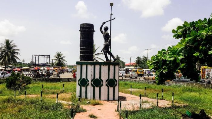
- Best Known for: an important place for the exportation of slaves from Africa to America and Europe during the slave trade era.
- Also Known As: Gbagli
- Major communities: Asipa Beach, Age Mowo, Afoo, Alakoto Meji, Aseri Owode, Dado
Badagry Local Government shares a border with the Republic of Benin. It is situated at the bank of lagoons, which is of utmost importance in the history of Nigeria, especially as the waters were used to transport slaves in history. There are many important places in Badagry, including the Royal Palace of Mobee (a Slave Relics Museum). It also houses the first storey building in Nigeria and the place where the Samuel Ajayi Crowther, the first African Church Missionary Society (CMS), lived and translated the Holy Bible from English to the Yoruba language.
Ojo Local Government Area
- Population: 838,900
- Size: 182 km2 (Area) 3,300 per km2 (population density)
- Headquarters: Ojo Drive, Ojo Town Lagos State
- Best Known for: being home of the Lagos State University (Ojo Campus), home to Alaba International Market
- Also Known As: unknown
- Major communities: Abagbo, Agaja, Alaba
Ojo was founded by Esugbemi and his wife Erelu and chief priest Osu. Currently, a Local Government Area in Lagos State, Ojo has some important landmarks such as the old Lagos International Trade Fair complex, Iyana-Iba market, and the divisional headquarters of 81 Division Nigerian Army and Navy Town, among others.
Epe Division
Urakaloye is the founder of Epe, which means forest of the black ants. The division constitutes of 2 Local Governments and 3 Local Council Development Areas known as Lekki, Ikosi-Ejirin, and Eredo. Historically, the division is important to the Epe people and the British for serving as a departure point for the military sent by the then Lagos Governor Sir Gilbert Carter to defeat the Ijebu political and spiritual ruler called Awujale at Ijebu-Ode. The Local Governments include:
Epe Local Government Area
- Population: 181,409 (2006 census)
- Size: 965 km2 (area)
- Headquarters: Ita-Marun, Epe, Lagos
- Best Known for: housing the Lagos State University (Epe Campus) and being a fish farming area.
- Also Known As: unknown
- Major communities: Lekki, Araga.
Epe is a farming community mostly known for fishing. The Local Government is situated on the north side of the Lekki Lagoon. It is also home for some notable Lagosians, like billionaire businessman Femi Otedola and former governor of Lagos State Akinwunmi Ambode, among others.
Ibeju-Lekki Local Government
- Population: 117,793 (2006 census)
- Size: 415.9 km2 (Area)
- Headquarters: Ibeju Lekki Local Govern Secretariat, Igando Oloja Ibeju-Lekki, Lagos
- Best Known for: becoming one of the most sought-after places in Nigeria by investors and home to industries that include Dangote Refinery.
- Also Known As: Unknown
- Most Popular places: Lekki town, Ibeju, Akodo, Orimedu, Eleko, Magbon Alade.
The name of the Local Government was gotten from two separate communities of Ibeju and Lekki. It has many non-indigenes settling in the community due to its being a tourist center and an economically inclined community. The Local government is also one of the fastest developing and most beautiful cities in Nigeria. It harbors places such as Victoria Island, Lekki Deep Seaport, LUFASI nature park, Pan-Atlantic University, Lagos Bar Beach, Lekki Toll Gate, and Lekki Conservation Area, among others.
Ikeja Division
The division consists of 8 Local Governments, including Lagos State’s capital, Ikeja. The division has over 50 settlements within the LGs. Below are the Local Governments found in the Ikeja division.
Agege Local Goverment Area
- Population: 459,939 (2006 census)
- Size: 12.25 km2 (area)
- Headquarters: 1A, J.J Obamero Road, Adealu Road, Dopemu, Agege, Lagos.
- Best Known for: being the former home of Dasab Airlines
- Also Known As: Ageigi
- Major Communities: Dopemu, Orile, Ogbam Asade, Iloro, Isale Oja, Oke-Koto, Ajegunle
Agege Local Government Area has gone through different stages in history before finally settling as an Independent Local Government Area. It was first created in 1954 and was merged with Ikeja District before splitting again. Six years later, it was again turned into a Local Government and has remained so ever since. Agege is a land of multiple ethnicities, with the majority being the Yoruba people. The Local Government also houses Lagos State University Agege Campus and National Youth Service Corps Permanent Orientation Camp.
Alimosho Local Government
- Population: 2,047,026 (2006 census)
- Size: 183.5 km2
- Headquarters: 3, Bada Street, Williams Layout, Akowonjo, Lagos
- Best Known for: the largest local government in Lagos State
- Also Known As: Alimoso
- Major communities: Ayoba/Ipaja, Mosam Okunola, Egbeda/Akowonjo
Alimosho has been tagged as the noisiest Local Government in Lagos State. The LGA is divided into Local Community Development Areas (LCDA), and it consists mainly of the Egbados tribe of the Yoruba language. It has some important landmarks like New Lagos Theatres, Igando, and Marturion Cinemas.
Ifako-Ijaiye Local Government Area
- Population: 427,878 (2006 census)
- Size: 43 km2 (area), 18.284 per km2 (population density)
- Headquarters: Aina Ajobo Street, Ogba, Lagos
- Best Known for: Sharing borders with Ogun State
- Also Known As: unknown
- Major Communities: Ogba-Ijaiye, Ifako, Oke-Ira, Iju-Ishaga, Obawole, Agege Pen Cinema.
Ifako-Ijaiye was removed from Agege LGA and made a Local Government in 1996 by the then Head of State, General Sani Abacha.
Ikeja Local Government (capital of Lagos State)
- Population: 313,196 (2006 census)
- Size: 42.31 km2 (Area)
- Headquarters: 2 Community Road, Ikeja, Lagos
- Best Known for: Being one of the most developed Local Government Areas in Nigeria.
- Also Known As: Akeja (former)
- Major Communities: Alausa, Computer Village, Lagos State Government Secretariat Ikeja House
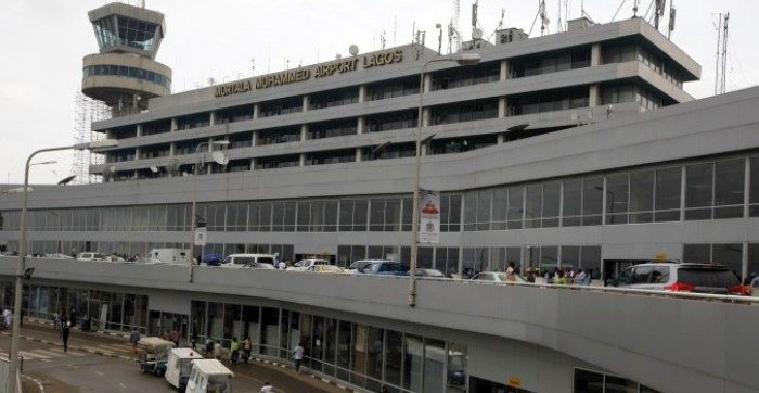
It is a well-planned and highly commercial city that became the capital of Lagos State in 1976. Historically, it served as a place for the raiding slaves. The Local Government is home to one of the busiest airports in Africa, Murtala Muhammed International Airport. It also harbors many head offices of different parastatals in Nigeria.
Kosofe Local Government Area
- Population: 663,393 (2006 Census)
- Size: 81 km2 (31 sq mi)
- Headquarters: Ohudu Road, Ojota, Lagos
- Best Known for: Sharing a boundary with Ogun State
- Also Known As: the beehive of activities and terminal for all food items across Nigeria
- Major Communities: Ikosi, Ojota, Ajao Estate, Mike 12, Kosofe, Ogudu
Kosofe was created in 1980, abolished in 1984, and on November 27, 1996, it became a Local Government in Lagos State. The local government is located in the northern region of Lagos and shares a boundary with other Local governments such as Ikeja, Ikorodu, and Shomolu. It also shares boundaries with Ogun State.
Mushin Local Government Area
- Population: 633,009 (2006 census)
- Size: 17.01 km2
- Headquarters: 82/84, Palm Avenue, Mushin, Lagos
- Best Known for: overcrowding, high industrial activities
- Also Known As: Unknown
- Major Communities: Ilupeju, Alakara, Babalosa, Idi-Araba, Ilasamaja
Mushin is a highly commercial center in Lagos State and a staple source of revenue in Nigeria. Due to the presence of many industries, it has attracted people of different backgrounds from many parts of Nigeria and beyond. However, this has contributed to the congestion of the Local Government, which has, in turn, added o the poor sanitation and housing in Mushin.
Oshodi-Isolo Local Government Area
- Population: 1,000,509 (2017)
- Size: 45 km2 (17 sq mi)
- Headquarters: Oyetoyo Street, Oshodi, Lagos
- Best Known for: Formed by Baba Kekere (Lateef Jakande)
- Also Known As: Osodi-Isolo (Oṣòdì-Ìsọlọ̀)
- Major Communities: Isolo, Ajao Estate, Oshodi/Bolade, Shogunle, Ilasamaja, Mafoluku
The Local Government, which was formed by the second republic governor of Lagos State, Alhaji Lateef Kayode Jakande, consists of 11 wards.
Somolu Local Government Area
- Population: 403,569 (2006 census)
- Size: 14.6 km2 (5.6 sq mi)
- Headquarters: Durosimi Street, Off Oguntolu Street, Bajulaiye, Somolu, Lagos
- Best Known for: Harbouring many Agberos (Area Boys), high crime rate, and home to one of the most diverse printing industries in the world.
- Also Known As: Shomolu
- Major Communities: Abule-Okuta/Ilaje/Bariga, Alade, Gbagada Phase 1 Obanikoro/Pedro, Palmgrove/Ijebutedo.
Somolu was created in 1976, and it previously bore the name Musin East Local Government. Due to the industrial advantage of Somolu, among other reasons, the Local Government has become a highly congested area with about 403,569 people as per the 2006 census. However, the Lagos State government thinks the population is way above that. Somolu is a highly noisy resident and has a high crime rate, high rate of poverty, touts, and high rent, among others.
Ikorodu Division
The division derives its name from Oko-Odu (vegetable farm). In its history, it served as a place where the founder of the place settled. It has been a major gateway to Nigeria’s hinterland. The division has only Ikorodu Local Government under it and Five Local Council Development Areas that include Igbogbo-Baiyeku, Ikorodu North, Ikorodu West, Imota, and Ijede.
Ikorodu Local Government
- Population: 536,619 (2006 Census)
- Size: 345 km2 (133 sq mi) Area
- Headquarters: Otunba T.O.S Benson Road, Ikorodu town, Lagos
- Best Known for: home to Lagos State Polytechnic
- Also Known As: Ikorodu Oga
- Major Communities: Imota, Aga, Igbogbo, Ibeshe, Ipakodo, Ikorodu.
Ikorodu is separated into about 16 to 17 minor areas. It shares boundaries with Ogun State, Kosofe, and Epe LGAs. Ikorodu has a lot of factories that help in boosting its economic growth. The Local government also has many tourist centers that include Ikorodu Lighter Port Terminal, Ipakodo, Voice of Nigeria (VON) Transmitting Station, Ikorodu, and Ijede Warm Springs, among others.
Lagos Division (Eko)

This is one of the decisions of Lagos State, and it consists of 5 different Local Governments and 8 Local council development areas. This division is highly urbanized and remains one of Nigeria’s most renowned and beautiful towns. In addition, Lagos Division is the central and most important economic center in Nigeria and the ECOWAS.
Apapa Local Government
- Population: 217,362 (2006 census)
- Size: 26.7 km2
- Headquarters: 37, Burma Road, Apapa, Lagos
- Best Known for: being a place where bronze hoard jewelry was found in 1907 and kept at the British Museum. It has ports and terminals.
- Major communities: Afolabi Alasia Str. and Environs, ApapaI (Marine Rd. & Environs), Apapa Creek, Ijora-Oloye, Gaskiya.
Apapa LGA, which is located at the West of Lagos Island, is one of the youngest local governments in Lagos State. It was initially created in 1980 before being merged with Eti-Osa LGA. However, in 1996, it was again created to become an independent LGA.
The Local Government houses many ports and terminals and is home to Thisday newspaper headquarters and refineries such as Bua Group.
Eti-Osa Local Government
- Population: 390,800 (2016 projection)
- Size: 174.9 km2 (Area)
- Headquarters: Igbo – Efon Km 15 Eto Osa – Epe Expressway, Lagos, Lagos State
- Best Known for: served as the seat of the Federal Government of Nigeria until 1990
- Major communities: Ikoyi, Victoria Island, Lekki Peninsula
Eti-Osa is one of the Local Governments in Lagos State. It is home to the Awori Yoruba people. It also harbors Northern immigrants that include Nupe and Gambari and is the home of diplomatic missions in Nigeria.
Lagos Island Local Government
- Population: 292,900 (2016 projection)
- Size: 8.7 km2 (Area)
- Headquarters: Zapass Building, 64, Freeman Street, Lagos State
- Best Known for: Served as Nigeria’s Capital from 1861-1991, economic center, and home to many headquarters of parastatals in Nigeria
- Also Known As: Ìsàlẹ̀ Èkó, Lasgidi
- Major communities: Isale Eko, Tinibu, Okepopo, Lafiaji, Idumota
Lagos Island is one of Nigeria’s most renowned, developed and beautiful cities in Nigeria. It was founded by Chief Olofin’s children called Idejo. Apart from being the former capital of Nigeria, it was also the capital city of Lagos State from 1967 – 1975.
Lagos Island has many landmarks and tourist attractions, including Tom Jones Memorial Hall and Library, Freedom Park, and Marina Road, among others.
Lagos Mainland Local Government
- Population: 449, 990 (2016 projection)
- Size: 20.18 km2
- Headquarters: 2, Ondo Street, Ebute-Metta (West), Lagos State
- Best Known for: being a major city in Nigeria
- Also Known As: unknown
- Most Popular places: Yaba, Ebutte-Metta, Akoka
The Local Government was founded by Chief Olofin and his people. The Local Government the one of the most developed in Nigeria in terms of infrastructures, the economy, and entertainment, among others.
Surulere Local Government Area
- Population: 503,975 (2006 census)
- Size: 23 km2 Area
- Headquarters: 19/29, Thomas Animashua Street, Aguda, Surulere, Lagos State
- Best Known for: Being home of entertainment, housing the National Arts Theatre
- Also Known As: a commercial Local government
- Major communities: Ojuelegba, Ojo, Igboile, Alagbede, Elesinmeta, Ayetoro
Surulere was established in 1967 and is located in the middle belt region of Lagos State on the mainland. Although home to Yoruba people, it also houses people from different places due to being a commercial area.
Surulere is home to many renowned Nigerians such as Wizkid, Oba of Lagos, Babatunde Fashola, and Desmond Elliot, to mention a few. The local government is known for fostering entertainment and remains an important part of the history of filmmaking in Nigeria. Also, the National Arts Theatre in Lagos, situated in Surulere, has been used in Beyonce Knowles’ music video, Key to the Kingdom, which features Tiwa Savage.
What Is The Richest Local Government in Lagos State?
Lagos is the richest State in Nigeria, and Lagos Island Local Government is the richest in the State, followed by Ikeja LGA, Eti-Osa, and Ijebu-Lekki LG. The Lagos Island LG generates much of its revenue from taxes as it is a highly commercial environment filled with industries, banks, and headquarters of many other companies and parastatals. Although it is not known exactly how much the Local Government generates, it contributes immensely to making Lagos State the richest State in Nigeria with a GDP of 399 billion Naira.
Which Is The Smallest Local Government in Lagos State?
In terms of population, Ibeju-Lekki is the smallest Local Government in Lagos State, with about 117,793 population, according to the 2006 census. However, in size, Lagos Island is the smallest, with an Area of about 8.7 square kilometers. The largest Local Government in Lagos State with regards to population is Alimosho, with more than 2 million population as reported by the 2006 population census. In size, Epe Local Government is the largest with 965 km2 (area).